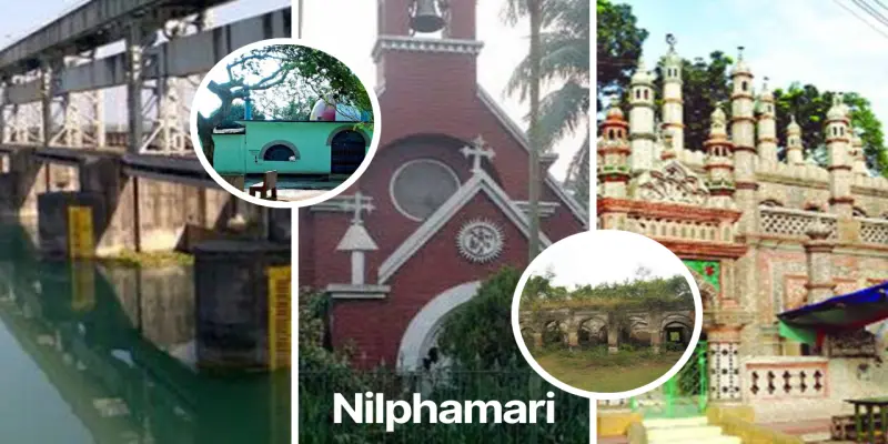
Nilphamari
Total Views : 361 | Published Date : April 16, 2025Geography:
Nilphamari District is a district in Northern Bangladesh. It is a part of the Rangpur Division. It is about 400 kilometers to the northwest of the capital Dhaka. Nilphamari is bounded by Rangpur and Lalmonirhat in east, Rangpur and Dinajpur in south, Dinajpur and Panchagarh in west, Cooch Behar of India in north. The headquarters are in Nilphamari, but the largest city is Saidpur.
Economy:
Nilphamari is the main industrial centre of Rangpur Division. Apart from Uttara EPZ, Many Governments and private industry situated here. Nilphamari has an agriculture-based economy. Nilphamari produces rice, wheat, potato, tobacco, and many seasonal crops. The major occupation of the people is farming. Among the working population 45.28% are farmers, 27.81% are farm laborer's, 3.42% are daily workers, 8.65% are businessmen, 6.07% are government and non-government employers, 8.77% have other occupations.
Places Must Visit:
Nilsagar Nilphamari, The palace of Raja Harish Chandra 9th century), Garh (Fort) of Raja Dharmapal and his palace (18th century), Three domed Jame Mosque at Bherbheri (18th century), Tomb of Hazrat Pir Mohiuddin (Kundupukur), Dimla Rajbari, Dimla Forest, Railway Workshop in Saidpur, Uttara Export Processing Zone, Tista Barrage, Saidpur Christian Catholic Church (1893), Saidpur Christian Cemetery, Chini Mosque Saidpur, Domar Maynamotir Garh, Chilahati Land Port, Parallel Watering System Bahagili Bridge Kishoreganj.
Categories
- Dhaka 13
- Chittagong 11
- Rajshahi 8
- Khulna 10
- Barishal 6
- Sylhet 4
- Rangpur 8
- Mymensingh 4
Featured Posts
