Khagrachari
Total Views : 302 | Published Date : April 09, 2025Geography:
Khagrachari is a hilly area. It is bounded by Tripura state of India on the north and west, Rangamati district to the east and Chittagong District to the southwest. Notable hill ranges are Golamoon, Chotto Panchari, Karmi Mura, Lutiban, Kuradia, Bhanga Mura, Jopisil. It has three rivers, namely Chengi, Feni and Maini. Chengi is the longest river in Khagrachari. The main ethnic groups living in the district are Tripuris, Chakmas, Bengalis and Marmas.
Economy:
Most of the people live on Jhum cultivation. There are also people of various professions like teacher, farmer and businessmen. Tourism is becoming a strong income source for the local. Main sources of income Agriculture 59.92%, non-agricultural labourer 9.33%, industry 0.44%, commerce 10.67%, transport and communication 1.11%, service 7.94%, construction 0.92%, religious service 0.24%, rent and remittance 0.37% and others 9.06%.
Must visit places:
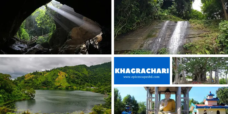
Alutila Cave, Matai Hakor, Matai Pukhiri, Tuari Mairang, Mayung Kopal, Palashpur, Tripuri people, Chakma people and Marma people.
Archaeological Heritage and Relics:
Among the archaeological heritages and relics, Rajbari of the Mong Circle and Dighi (large pond) of Dighinala (excavated by Gobinda Manikya Bahadur exiled king of Tripura) are notable, Horticulture Heritage Park, Hajachora Waterfall, Toiduchara Waterfall, New Zealand Para.
Categories
- Dhaka 13
- Chittagong 11
- Rajshahi 8
- Khulna 10
- Barishal 6
- Sylhet 4
- Rangpur 8
- Mymensingh 4
Featured Posts
